Holographic Intersection Solution
Provides high-precision and low-latency real-time road information services at urban intersections to improve driving safety and ensure pedestrian safety

Play Video
Introduction
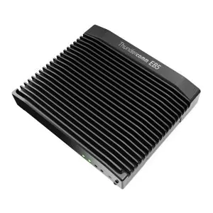
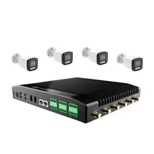
Thundercomm Holographic Intersection Solution provides a foundation for digitizing the transportation industry. The solution gathers high-precision, low-latency traffic information in real-time and basic infrastructure data through roadside sensors and computing devices and works with a cloud control platform to improve traffic efficiency and safety. It works in dynamic time assignment of traffic lights, dynamic lanes, regional traffic optimization, and accident handling applications.
Benefits

Provide a dynamic traffic view of an intersection from a god-view perspective

High accuracy perception and positioning (maximum positioning error < 30cm), served as a crucial support for vehicle which can receive the data from the roadside

Ultra-low latency perception output (visual perception latency < 90ms), supporting low latency road scenarios

Provides open data interface APIs to promote industry development
Architecture
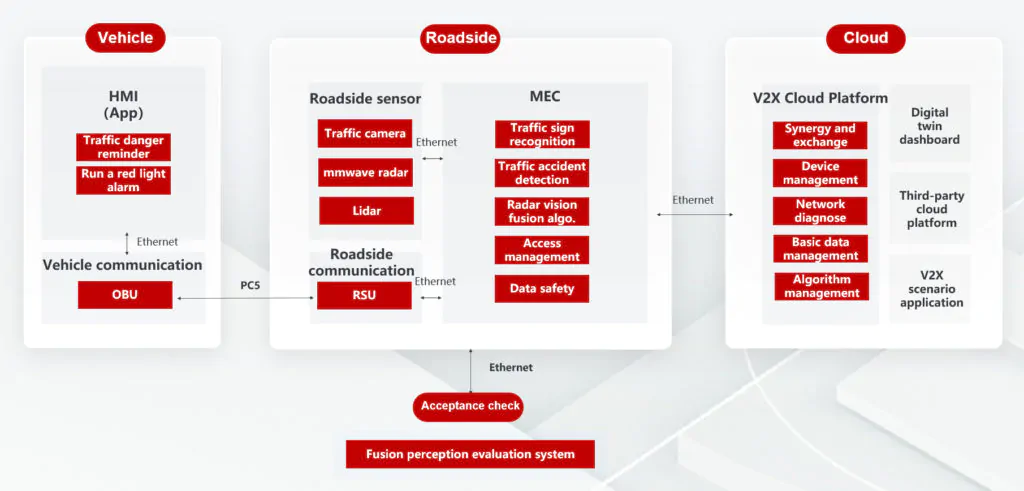
The overall architecture includes three ends: vehicle, road, and cloud. Road realizes the perception and fusion of traffic information based on roadside sensors and edge calculation, and it communicates with vehicles through RSU and vehicular OBU to send and receive road information. Road and cloud are mainly cloud-controlled platforms and interact with traffic detection data through ethernet. Based on the intersection’s holographic data, can realize scenarios including digital twin intersections, data services, and other V2X scenarios.
Finally, it can verify and evaluate through an integrated perception and evaluation system can.
Holographic Intersection Scenario Algorithms
|
Type
|
Algorithms
|
|
Perception Algorithms
|
• Traffic Object Recognition Output types: Target Types: Support the detection of four types of vehicles: car, buggy, truck, and bus; two non-motorized vehicles: motorcycle (electric bikes) and bicycles; pedestrians
▫ Size of traffic objects (length, width, height) ▫ Location (longitude, latitude, WGS-84 coordinates) ▫ Speed ▫ Heading angle
|
|
Fusion Algorithms
|
• Millimeter wave radar fusion • Lidar fusion
|
|
Traffic Flow Detection Algorithms
|
• Vehicle queue length detection • Vehicles’ average speed detection • Headway spacing detection • Total traffic volume detection • Lane-level traffic volume detection • Lane time occupancy detection • Average headway visual distance detection • Lane spatial occupancy detection • Average distance between vehicles detection |
|
Traffic Incident Detection Algorithms
|
• Pedestrian intrusion • Abnormal parking • Wrong way • Illegal lane change • Lane congestion • Objects falling from vehicles
|
Perception Algorithms
• Traffic Object Recognition Output types:
Target Types: Support the detection of four types of vehicles: car, buggy, truck, and bus; two non-motorized vehicles: motorcycle (electric bikes) and bicycles; pedestrians
▫ Size of traffic objects (length, width, height)
▫ Location (longitude, latitude, WGS-84 coordinates)
▫ Speed
▫ Heading angle
Fusion Algorithms
• Millimeter wave radar fusion
• Lidar fusion
Traffic Flow Detection Algorithms
• Vehicle queue length detection
• Vehicles’ average speed detection
• Headway spacing detection
• Total traffic volume detection
• Lane-level traffic volume detection
• Lane time occupancy detection
• Average headway visual distance detection
• Lane spatial occupancy detection
• Average distance between vehicles detection
Traffic Incident Detection Algorithms
• Pedestrian intrusion
• Abnormal parking
• Wrong way
• Illegal lane change
• Lane congestion
• Objects falling from vehicles
Application Scenarios

Thundercomm is the general software integrator for the Wuxi Xidong New City Internet of Vehicles Demonstration Project (Phase I) and Wuxi (Xishan) “AI infrastructure and Internet of Vehicles” Pilot Core Area Project.
We have designed and developed the basic data management platform of intelligent connection, open traffic information platform, urban navigation optimization with C-V2X, V2X information visualization on mobile APPs, V2X-Uu scenario applications, and road-vehicle data exchange platforms.
We are working with six device manufactures and seven APP providers to work out the integration standard protocols.
